Aerial Intelligence for Smarter Operations
A SMARTER WAY TO INSPECT.
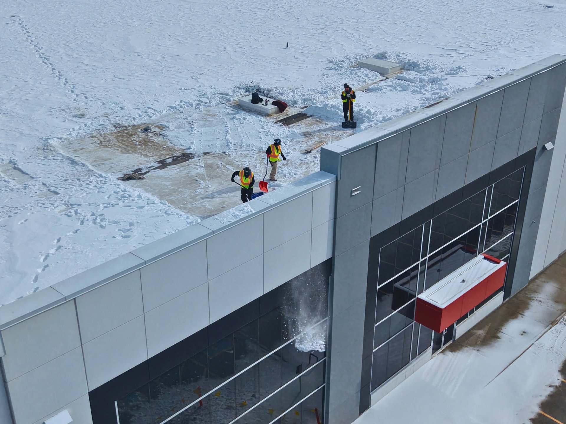
Find leaks, ponding, and membrane damage across your Ontario property portfolio without lifts, ladders, or tenant disruption.
48HR
4K
$6M
Turnaround available
Videography
Liability coverage
From a single roof inspection to a full construction season of progress documentation, DroneWise delivers professional aerial data with the reliability commercial clients expect.
About us
Use this space to introduce yourself or your business to site visitors. Share who you are, what you do, and the purpose of this website. Feel free to include your background, experiences, and any unique aspects that set your business apart. Highlight your mission, values, and the benefits your customers can expect.

Free Consultation
Tell us your address, square footage, and what you’re trying to figure out — leak source, capital planning, insurance claim, or pre-purchase.
Safer. Faster. and More Thorough.
HOW IT WORKS
01
Our certified RPAS pilot arrives, captures your entire roof in two hours or less, and packs up before your tenants notice anything has changed.
You receive your full Roof Condition Report within five business days which includes aerial imagery, thermal scans, and recommended next steps.
On-Site Flight
Report Delivery
02
03
Our services
Provide a general summary of the services you provide, highlighting key features and benefits for potential clients.
2D Overhead Roof Map


Write a short text about your service. Highlight key benefits for potential clients.


Aerial Video Flyover
Write a short text about your service. Highlight key benefits for potential clients.
Write a short text about your service. Highlight key benefits for potential clients.
Service title
ROOF & STRUCTURAL INSPECTIONS
Get a complete visual record of any roof or structure without sending anyone up a ladder. Ideal for insurance claims, pre-purchase assessments, maintenance planning, and post-storm surveys.
FOUR SERVICES.
ONE CERTIFIED TEAM.
WHAT WE DO
Every service is delivered by TC Advanced certified pilots carrying $2M liability insurance — the standard commercial clients and insurers require.
4K imagery of all roof surfaces, flashings, and penetrations
Annotated inspection report with flagged defects
Thermal imaging available for moisture detection
Suitable for flat, steep, and metal roof systems
Insurance-ready documentation format
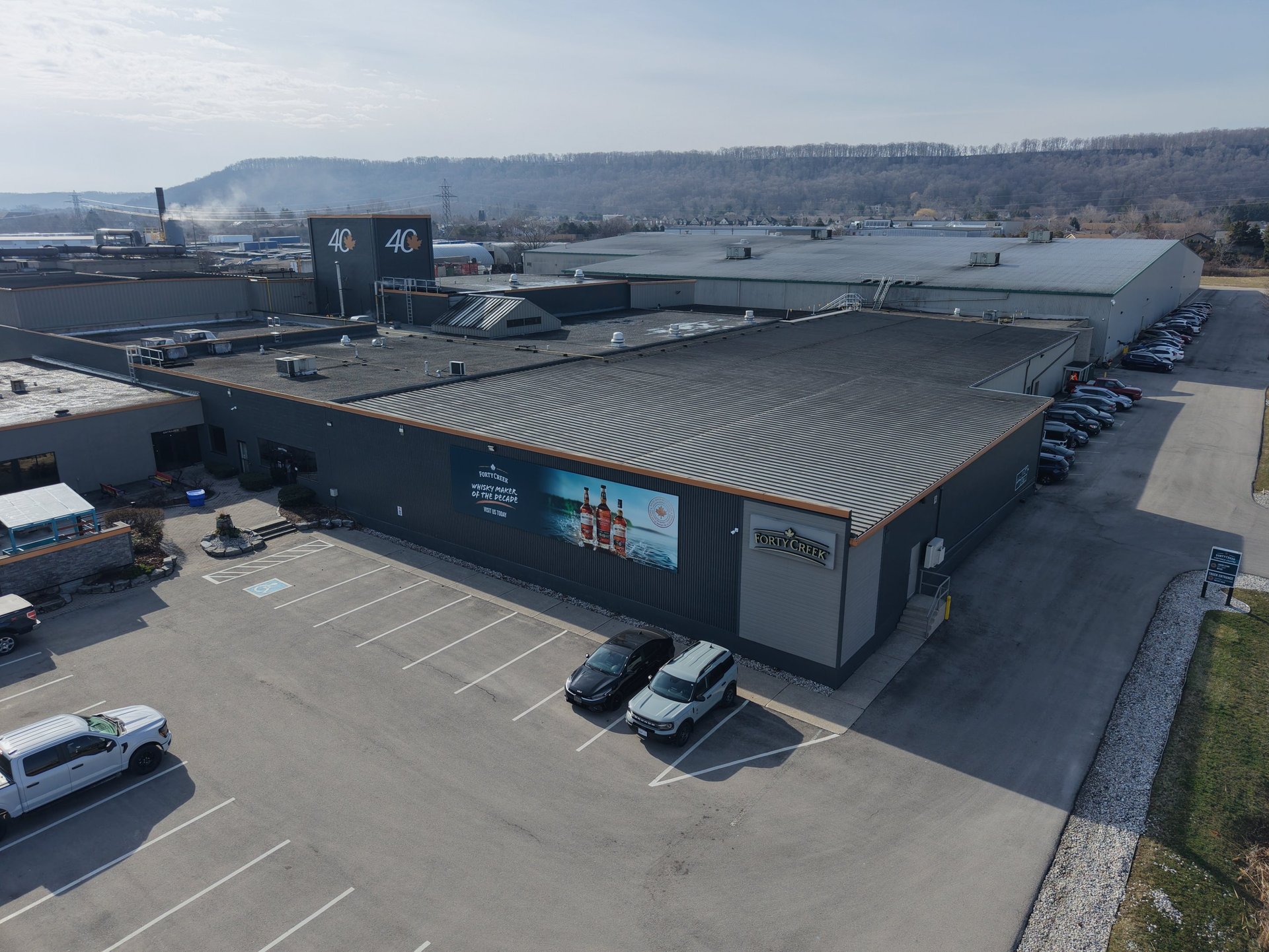
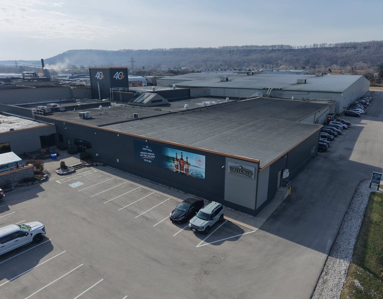
CONSTRUCTION PROGRESS PHOTOGRAPHY
A consistent aerial record of your site from groundbreak to handover. Scheduled flights at agreed intervals give owners, project managers, and stakeholders a reliable visual timeline of every phase.
Scheduled weekly, bi-weekly, or monthly flights
Matched framing across visits for direct comparison
High-resolution stills delivered in 24 hours
Suitable for residential, ICI, and infrastructure projects
Archived library of every visit for the project record
CONSTRUCTION PROGRESS VIDEO
Cinematic aerial footage that tells the story of your project. Use it for investor updates, marketing, tender packages, or internal reporting — production-ready and delivered edit-ready.
4K stabilised video footage
Colour-graded and edited to your brief
Timelapse sequences from multi-visit footage
Ground-level and aerial combination packages available
Delivered as MP4 optimised for web, social, or presentation
SITE MAPPING & SURVEYING
Accurate 2D orthomosaic maps and 3D site models generated from photogrammetric missions. Suitable for earthwork volume calculations, site planning, and progress measurement against design drawings.
Orthomosaic maps to 2–3cm ground resolution
Digital elevation models (DEM) and contour data
Cut & fill volume calculations
Outputs in DWG, DXF, GeoTIFF, and LAS formats
Compatible with AutoCAD, Civil 3D, and Trimble
SITE SNAPSHOT
1 site visit (up to 30 mins of flight time)
4K project highlight video (1–2 mins)
5 high-resolution still photos
Delivery within 7 business days
PRICING PACKAGES
All packages include a TC Advanced certified pilot, $6M liability insurance, edited deliverables, and digital file transfer. Custom scopes quoted on request.
2 site visits (up to 45 mins of flight time each)
4K End-of-project highlight video (2-3 mins)
10 high-res stills per visit
Branded intro/outro and music licensing
Delivery within 5 business days
Orthomosaic mapping to 2–3cm resolution
Digital elevation model & contour data
Cut & fill volume calculations
CAD-ready export (DWG, DXF, GeoTIFF)
Thermal roof inspection available as add-on
Full annotated inspection report
PROGRESS PACK
SITE INTELLIGENCE
SINGLE VISIT
SEASONAL DOCUMENTATION
SURVEY & INSPECTION
$500/visit
$700/visit
$900
Up to 30 mins on site - within 50km of Hamilton
Minimum 2 visits - billed monthly - pricing per visit
Scoped per project size & complexity
One flight, one deliverable. Ideal for a single inspection, a one-off progress record, or a quick site capture.
MOST POPULAR
STRAIGHTFORWARD. NO SURPRISES.
Scheduled visits across your construction season. Full photo and video documentation at every milestone.
Full mapping, survey, and inspection capability for projects that need accurate spatial data alongside visual documentation.
Starting at
Ready to get above it?
Tell us about your project and we'll put together a quote, usually within one business day. We service commercial clients across Southwestern and Central Ontario.
© 2026 Dronewise Ltd.
Contact Us
COMPANY
RESOURCES
ROI Calculator
Service Locations
Ontario Drone Report
Our Story